Description
I worked alongside 10 other collaborators from all over the world for 8 weeks. We had weekly task meetings and team meetings.
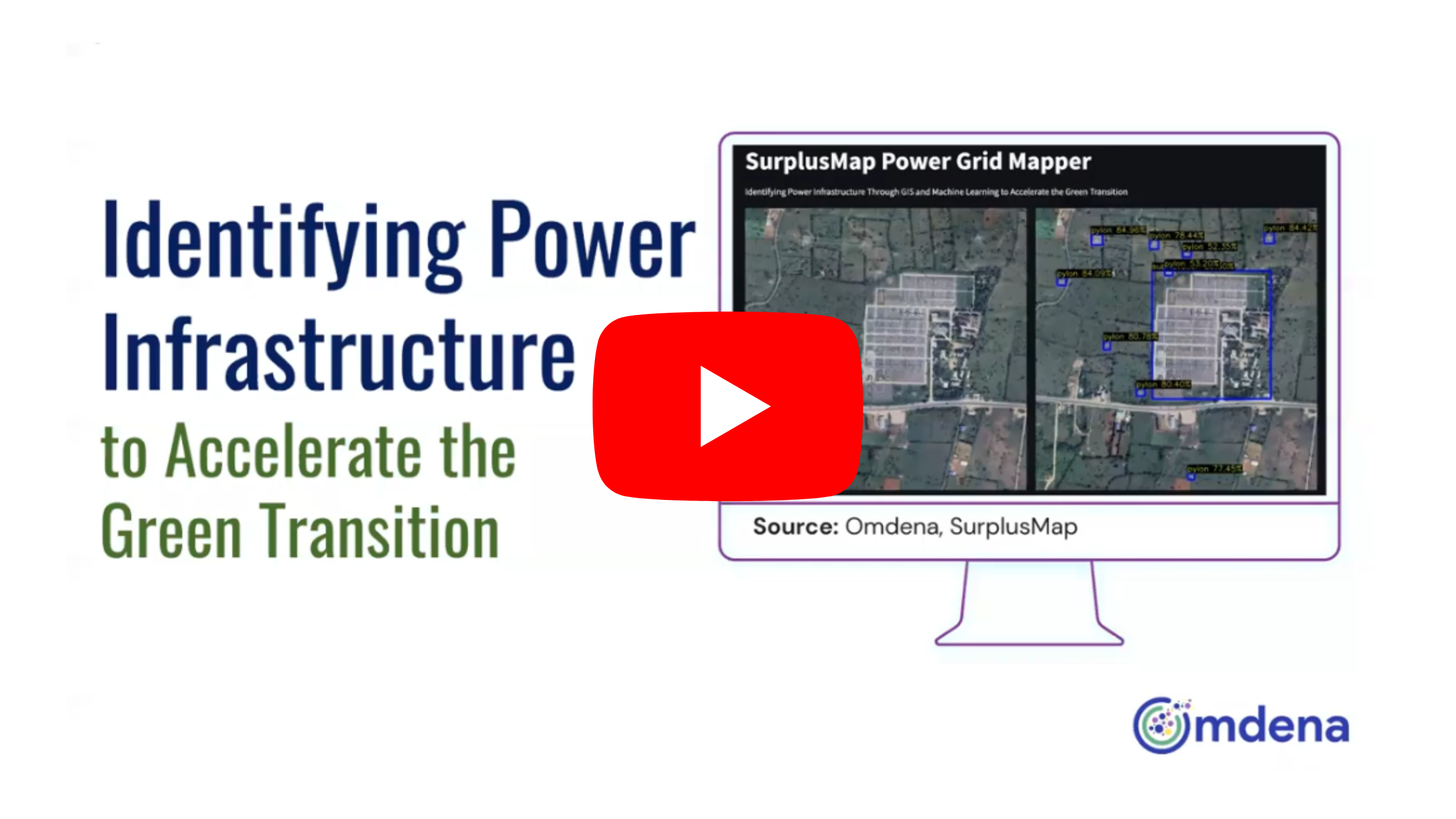
The problem statement aimed to identify Power Infrastructure (power stations, substations and pylons) in India to accelerate the Green Transition. This is done to aid the decision-makers to make better and safer decisions for the development of new green industries. The identification of Power Infrastructure was done by employing Geospatial Machine Learning. That is, the objective was to leverage satellite imagery and other geospatial data in conjunction with machine learning approaches to automatically identify power grid infrastructures such as pylons, substations, and power stations.
The region of interest is India with a concentration in Rajasthan, West Bengal, and Himachal Pradesh.
As a team member, I worked on various aspects of the project including research, data collection, preprocessing and labeling, as well as documentation.
The steps involved in this project were:
(1) Data Collection – using SAS Planet, Google Earth Map
(2) Data Preprocessing – Annotating the images with labels using LabelBox (for type: pylons, substations, power stations; blur: high, medium, low; split: cropped, fully visible), splitting the data into train and validation datasets
(3) Modeling – used YOLOV5X for training; models such as YOLOv5(S/L/X) and YOLTv5 were trained using the collected data on Google Colab GPU
(4) Deployment – building a web application, deployed using Docker to AWS leveraging AWS ECR (Elastic Container Registry), SAM (Serverless Application Module), AWS Lambda and AWS API Gateway services
(5) Documentation
